On Tuesday, March 15, two former CIA employees will delve into the world of geospatial intelligence—a form of intelligence-gathering that relies on satellite, drone, and aircraft imagery—and discuss its use and applications in the conflict in Ukraine.
Michael J. Ard and Jack O'Connor, both program directors with the Advanced Academic Programs division of Johns Hopkins University's Krieger School of Arts & Sciences, will host a virtual discussion titled "Conflict in Ukraine: The Geospatial-Intelligence Perspective" from 2 to 3 p.m.
Ard, program director and senior lecturer for the Master of Science in Intelligence Analysis program, is a former CIA analyst and manager and former deputy national intelligence officer for the western hemisphere in the Office of the Director of National Intelligence. O'Connor, director of the MS in Geospatial Intelligence program, is a former CIA officer who spent his government career managing, leading, and writing about imagery and geospatial analysis.
In advance of their talk, the Hub reached out to Ard and O'Connor to understand more about geospatial intelligence and its impact on the growing conflict between Russia and Ukraine.
What is geospatial intelligence?
O'Connor: Geospatial Intelligence combines the human ability to envision, discover, record, comprehend, and track events on the ground by using sensors from drones, aircraft, and satellites. It grew out of cartography and imagery analysis and was initially developed by governments for military and strategic purposes. But with the advent of commercial and small satellite imagery, along with geographic information systems and GPS technologies, it has expanded to the commercial and private sector.
It's collected every day by private and government satellites and drones and with cell-phone cameras, and, when reviewed by trained analysts, it can reveal locational, environmental, military, and social information in denied areas of the world, such as the current situation in the Ukraine.
What have we learned about the situation in Ukraine as a result of this form of intelligence gathering?
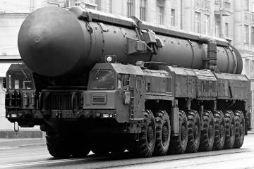
Ard: Unlike in past conflicts, much of the build-up to the war, and then Russia's attack on Ukraine, has been told by images provided by geospatial intelligence. We have seen, published in the media, satellite photographs of Russian troops massing on the border and long columns of tanks advancing in the Ukrainian countryside. Most of these images have come from commercial satellites. Geospatial intelligence has been around for a long time but rarely has the public had this kind of routine exposure to it. Some of the questions we want to ask are, how do we interpret this extraordinary form of intelligence? What are its strengths and limitations? What should we be looking for from geospatial intelligence as this tragic conflict proceeds?
How else is Geoint being used in Ukraine?
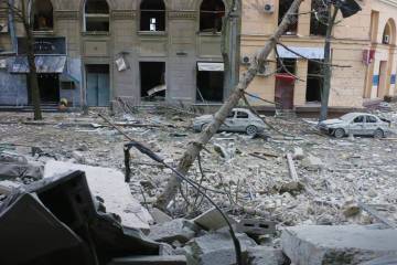
O'Connor: It's being used to validate reporting from other sources, identify battle damage, locate military equipment and refugee movements, and monitor border security and sensitive installations like nuclear power plants, airports, petroleum storage, port facilities, and lines of communication.
It has many advantages: Geospatial intelligence can monitor the conflict and the social changes in Ukraine in near-real time. It cannot be jammed like radio or television signals, or turned off like Russia has started to do with social media. It can also track humanitarian issues such as refugee flows and refugee camp construction, as well as systemic destruction of cities or Ukrainian infrastructure. It can also play a part in any future peace negotiations, treaty monitoring, and potential war crimes, as well as identify any environmental disaster that may result from the invasion.
Finally, with the growth of commercial synthetic aperture radar satellites, it can provide information at night and on cloud-covered days.
Hear more from Ard and O'Connor during their talk, taking place 2-3 p.m. on Tuesday, March 15.
Posted in Science+Technology, Voices+Opinion, Politics+Society