- Name
- Rose Weeks
- rweeks@jhu.edu
- Office phone
- 347-804-6526
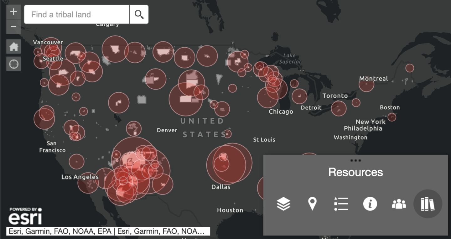
The Johns Hopkins Coronavirus Resource Center today launched new data and maps tracking the pandemic's impact across American Indian and Alaska Native communities.
Developed in collaboration with the Johns Hopkins Center for American Indian Health and Indian Country Today, the map provides one of the most comprehensive views of how the pandemic has unfolded across more than 100 Tribal Nations.
American Indian and Alaska Native communities have been experiencing some of the highest rates of COVID-19 in the United States. There are, however, substantial gaps in the availability of COVID-19 information about Tribal communities in publicly accessible databases.

The gap in data was recognized by Indian Country Today editors, who began tracking publicly available data in an open-access spreadsheet. The new maps of Tribal Nations streamline data collection efforts and provide visualizations to display the pandemic's disparate impact in areas not typically monitored by mainstream media sources. COVID-19 has amplified health inequities in American Indian communities because of underfunded and under-resourced health systems, limited access to health services, poor infrastructure, and underlying health disparities. For example, American Indian or Alaska Native individuals were 3.5 times more likely to be hospitalized for the virus.
"The maps help make visible the impact of COVID-19 on Native peoples," said Allison Barlow, director of the Johns Hopkins Center for American Indian Health and a senior scientist in International Health at the Johns Hopkins Bloomberg School of Public Health. "Many tribes have achieved exceptional vaccine coverage rates in spite of struggling with chronic health care access issues and other persistent socioeconomic challenges and underlying risks that make COVID-19 an ongoing threat."
To access the Tribal Nations data, on the U.S. map, use the tabbed navigation at the bottom of the map window.
Data for the maps is updated regularly from publicly available sources provided directly by Tribes. This may include social media posts, Tribally run websites or dashboards, radio broadcasts, webinars, and other methods. For more than a year, volunteers from universities and organizations across the country have collected data in an effort coordinated through the Center for American Indian Health.
The maps have been adapted from two of the primary sources for geographic information about Indigenous communities: the Indian Health Service's continental United States map and Esri's map of Alaska Native Village lands. The depictions of the Tribal Nations on the Johns Hopkins maps are not fully inclusive representations of all land boundaries for American Indians or Alaska Natives and are limited to federally recognized Tribal Nations in the continental United States and Alaska Village lands.
The map identifies U.S. counties that intersect with federally recognized Native land reservations and displays the most up-to-date COVID-19 data available for those counties. This depiction of data will not be a perfect representation of the pandemic's burden in specific Tribal communities where borders do not align directly with county lines. But the mission is to clearly show the disparate impact COVID-19 has had on American Indian and Alaska Native communities while also respecting Tribal sovereignty and individual privacy.
For the most accurate COVID-19 rates for these communities, contact representatives for the appropriate Tribal, regional, or Urban Indian health programs.
The map also does not currently include Urban Indian populations and it does not intend to represent official or legal boundaries of any Indigenous communities.
Posted in Health, Science+Technology
Tagged health disparities, center for indigenous health, covid-19


