

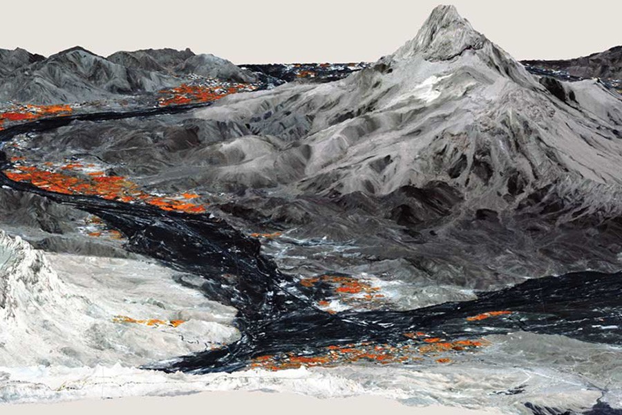
Michael Harrower and Ben Zaitchick of the Krieger School use satellites to study archaeological histories. Here, a Worldview-2 satellite image of an oasis near Yanqul, Oman, has been laid over a topographic image from Japan's Advanced Land Observing Satellite. In this image, various wavelengths of light are selected to highlight things not visible to the naked eye—the type and health of modern vegetation, shown in shades of orange, and variability of ground surface texture and composition, shown in shades of blue, green, and gray. These details of the modern landscape inform hypotheses and models on the locations and productivity of irrigated agriculture in the ancient past.
Posted in Science+Technology, Politics+Society
Tagged archaeology, history, space, satellites, landscape, agriculture, maps